
credit: DJI.com
#dronesforgood
Here, we showcase a few of the incredible examples of work being done by the drone industry. From working in the field ourselves, we understand that drones have gotten a bad reputation from a few spoiling the broth for the many. So we want to show you how they're being used for good!
Protection of cultural heritage
With the 3D models generated from DJI Terra, a Japanese city now has access to every little detail on the construction of a centuries-old historical monument.
Construction of the Karatsu Castle began in 1602 and lasted for seven years. The stone walls that make up the castle tower are the only parts that remain from the original construction. Their historic value is immense. “But these stone walls are being pushed out due to the effects of water seepage caused by earthquakes and heavy rains that have occurred many times in the past,” explains Satoshi Kimoto.
With the 3D models generated from DJI Terra, the City of Karatsu now has access to every little detail on the construction of its namesake castle. Kimoto from the City Planning Division says, “Once a stone wall is broken, it is very difficult to recover the site to its original state. Therefore, having an updated and well-documented record of the property is essential. These models can be saved and stored for future use, especially in the case of a natural disaster.”
credit: DJI.com

Forest fire management
First-Time Drone Use in Major Chilean Emergency Operation Leads to Higher Demand of UAS Programs.
Throughout January and February 2017, relentless forest fires swept through the central regions of Coquimbo, Los Lagos, O'Higgins, Maule, and Biobío, as well as the southern region of Magallanes. 587,000 hectares of land were left in ruins, as was the property of thousands of people.
DroneSAR Chile, the first NGO consisting of Chilean volunteer drone operators, would offer their emergency response services. What the fire department needed was support from the air, which would be provided through thermal imaging, live video feeds, and telemetry.
For the first time during a major emergency response mission, fire and brigade commanders relied on drone derived thermal imaging technology to continue operations at night. Fire departments in different regions were able to collect valuable information, which enabled them to make safer decisions and reduce any risk to themselves and their team. It also allowed them to prioritize hotspots, which minimized the damage to civilians and the ecosystem.
credit: DJI.com

Agriculture
The efficient application of agricultural spray product, is a persistent challenge for any grower. If you spray too much concentrated in one place, you run up extra costs and potentially decrease the quality of your produce. Too low a concentration, however, and you leave your crops vulnerable to being overgrown with weeds, malnourished, or eaten by insects and other predators — potentially decreasing the yield rate.
However, the right farming drones, such as the DJI Agras T10 photographed, and spraying payloads can distribute chemicals evenly and efficiently.
The results? Improved crop quality and a higher yield rate without intense manual labor. DJI drones can be used on nearly any kind of crop, including rice, wheat, corn, citrus trees, cotton, and much more.
credit: DJI.com

Radio-tracking
The Australian company 'Wildlife Drones' are leading the industry in drone based wildlife radio tracking.
By utilising radio-telemetry, Wildlife Drones offer a kit that enables customers to tag the intended wildlife with VHF radio tags which can then be tracked via a device attached to a drone. By flying the drone, and accompanying sensor in an area of interest, all tagged individuals in range of the drone will be identified and subsequently recorded.
This technology enables the efficient tracking of wildlife in potentially unfavourable and rugged terrain that would otherwise be time consuming and potentially dangerous for humans undertaking the same task.
credit: wildlifedrones.net
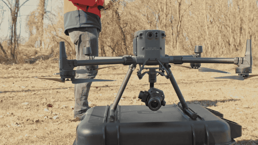
Earthquake response
Rescue operators deployed Matrice 300 RTK and Phantom 4 RTK drones to map an earthquake-hit Petrinja, Croatia.
UAS teams were quickly deployed to get the lay of the land, provide food and water, and conduct a first assessment of the damage caused by the shakes.
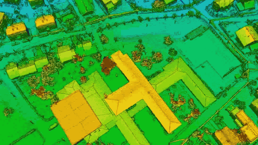
While locating people covered by rubble is one of the primary reasons why drones are used in disaster scenarios, it is thanks to detailed orthomosaic maps that a search and rescue mission can be planned in the first place.
Nowadays, drone mapping for disaster response is indeed the most time and cost-efficient way to inspect and collect data, while simultaneously running rescuing operations.
credit: DJI.com